
The River Trent is the main waterway that runs near Birmingham. It is 185 miles long and flows from Staffordshire through the East Midlands to the Humber estuary. It is clear that the river is a vital historical transport link. Although the Trent does not flow directly through Birmingham, the river nevertheless connected two important industrial canals, namely the Trent and Mersey Canal, which served as important commercial arteries for Birmingham’s industrial development from the 18th century onwards.
As a result, the river has firmly established itself as one of the main waterways in the West Midlands region. In fact, it should be noted that in Birmingham itself, a significant part of the old canals and small rivers, such as the River Soulsby and the River Rea, played a key role in the industrial development of the city, but you can read more about all this here: birminghamname.com.
Birmingham’s waterways: the heart of industrial revolution logistics
The story of the River Trent should begin with the fact that Birmingham is a city that for centuries was one of the main centres of the industrial revolution in Great Britain. It is often referred to not so much as a city of metal and factories, but rather as a “city of water,” because it was its waterways that determined its logistics and development.
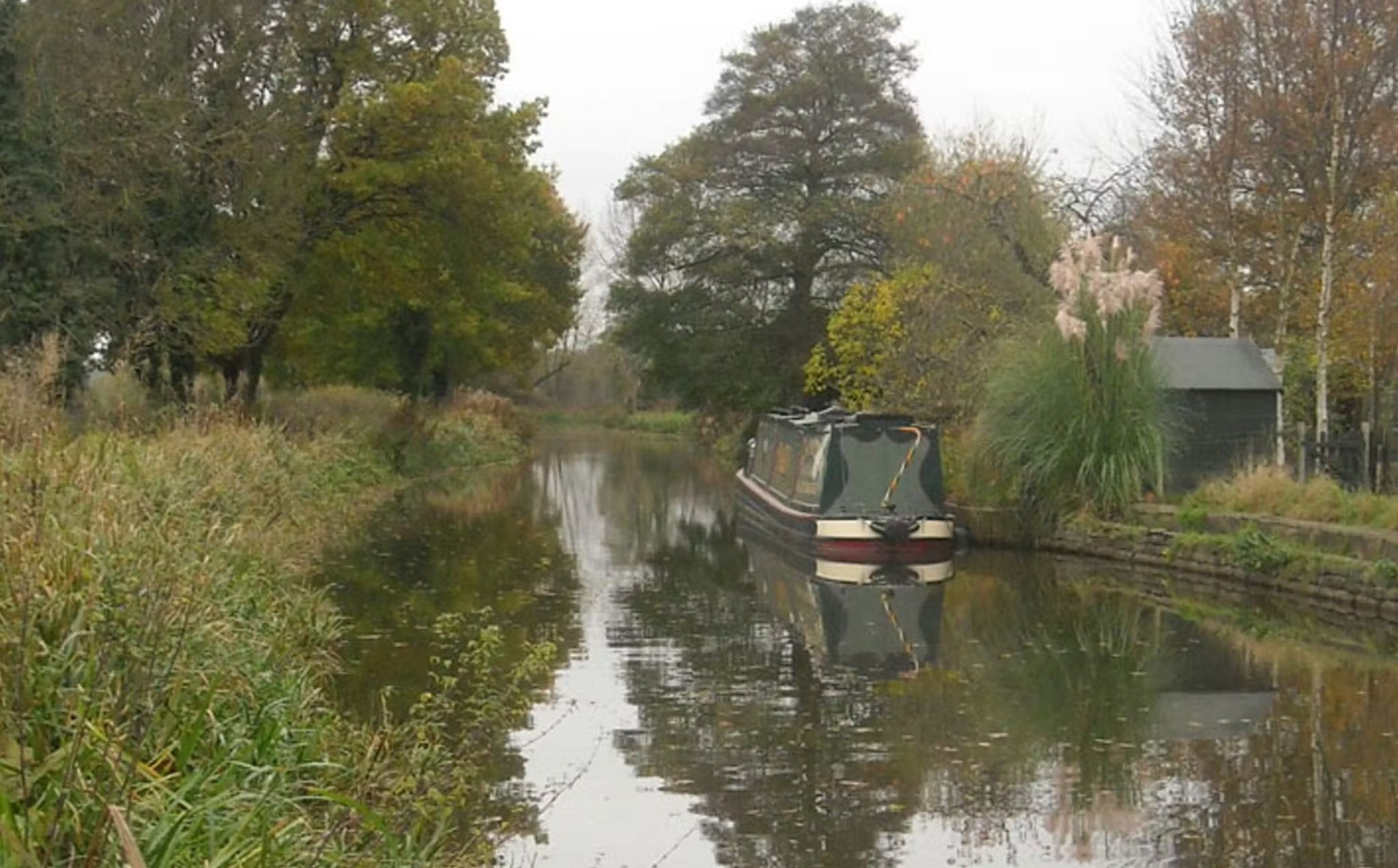
In the 18th and 19th centuries, efficient and inexpensive transportation of goods was crucial for industrial enterprises. And so, instead of modern railways and motorways, Birmingham built its unique logistics system around rivers and artificial canals. The canals, which today are perceived as a picturesque historical landscape, were at that time real “motorways” along which barges carried coal, metal, raw materials and other goods.
But among all the waterways surrounding the city, the great River Trent played a special role. It was this river, its tributaries and the canal system built by the people of Birmingham that formed a network without which it is difficult to imagine the industrial boom of Birmingham.
The River Trent is one of England’s largest rivers, originating in the hills of Nottinghamshire and flowing northeast, gradually widening and turning eastwards before joining the River Humber. It is over 300 km long, and its basin covers a significant part of central England.
The Trent has always been an important natural artery. Long before the Industrial Revolution, it was successfully used to transport goods and people. At that time, boats could move along full-flowing sections and, thanks to artificial structures, partially even overcome uneven terrain.
But the real explosion in the importance and significance of this waterway came with the development of industry. The river was connected to artificial canals—narrow water corridors that ran directly through industrial areas. Through this system, small ships and barges could deliver coal from mines and metal from factories, and then return with finished products.
“Megawatt Valley”
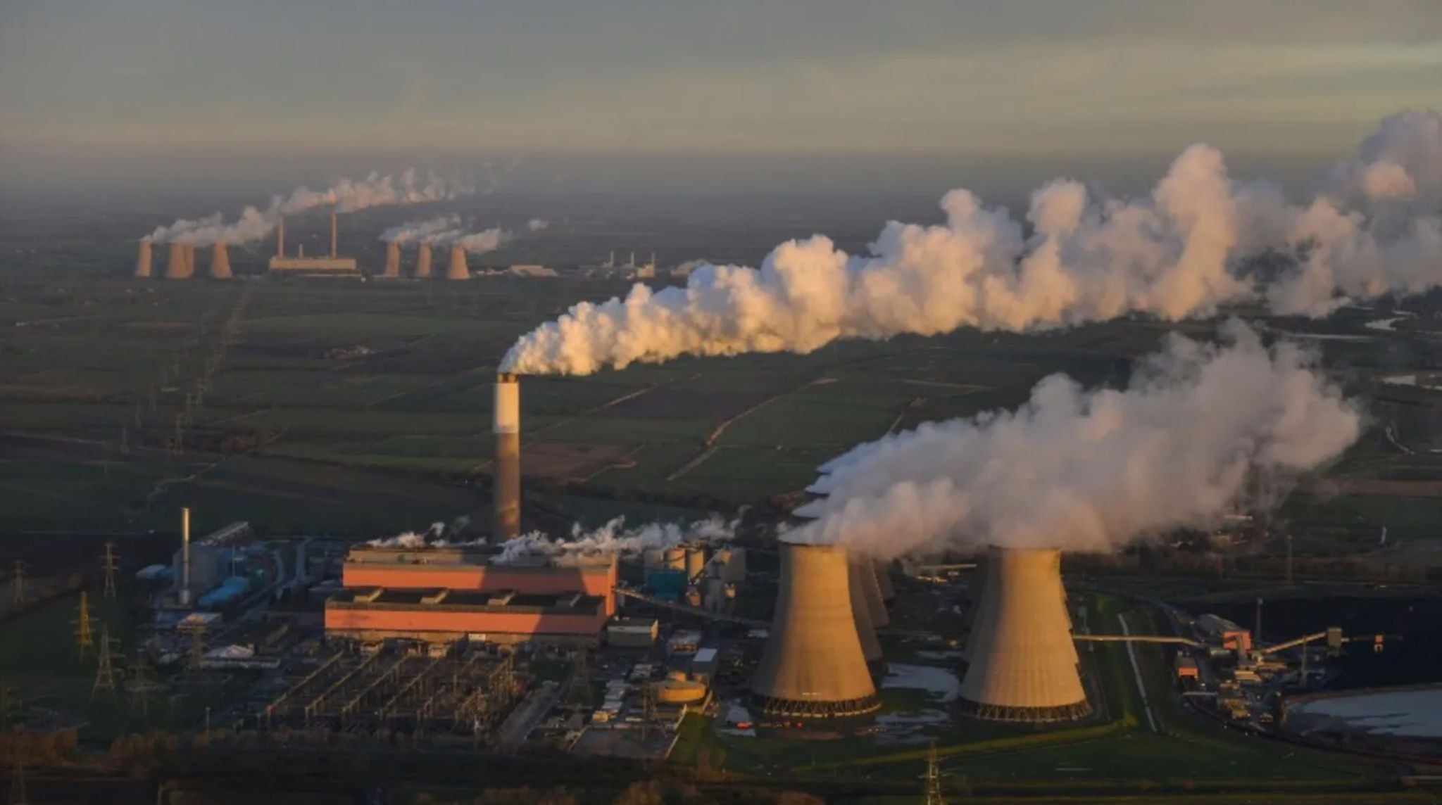
In the mid-20th century, Birmingham found another important use for the river. A unique energy zone, known as the “Megawatt Valley,” was created along the riverbanks.
It is therefore clear that this was not just a geographical region, but a true symbol of industrial power. Huge coal-fired power stations sprang up on the banks of the river, stretching one after another to form a line of industrial giants, whose cooling towers and chimneys rose tens of metres above the valley.
The reason for their concentration was quite practical. The river provided a large amount of water for cooling the turbines, and nearby, in the north of England, there were coal deposits and a developed railway infrastructure, which simplified fuel delivery.
One of the first stations was Staythorpe A, and later others appeared along the Trent: Castle Donington, Willington, Drakelow, Cottam, West Burton and Ratcliffe-on-Soar. Incidentally, the latter station was one of the largest in the country. This concentration of production capacity enabled this area to supply up to a quarter of all electricity in England and Wales.
Particularly notable was High Marnham Power Station, which was built in the mid-1950s and commissioned in 1962. It had a capacity of 1,000 MW and was considered one of the largest in Europe at the time. The station ran on coal, burning huge amounts of fuel to generate electricity and using cold river water to cool its powerful turbines.
This cascade of power stations not only created jobs for thousands of people in the region, but also became part of the country’s national energy system. It constantly produced megawatts for plants, factories, households and entire cities. For decades, a unique spirit of competition and technological progress prevailed, and the Trent Valley itself became the embodiment of the coal energy era, which was once the heart of British industry.
As a result, the history of the Midland Waterway became legendary among 19th-century engineers. Although it is known that when designer John Smith first proposed connecting the river to a network of canals, many critics at the time considered it a waste of money. However, within a few years, the combined system proved its effectiveness, and Birmingham became one of the main logistics hubs of industrial Britain.
The ecology of the River Trent: from industrial pollution to regeneration
The industrial revolution also had its dark side. Along with the boom in factories and plants in the 19th century, the River Trent became a recipient of huge amounts of waste water, industrial waste and rubbish. As a result, the river suffered significant environmental damage. What’s more, the water became murky, the smell of pollution spread over large areas, and many species of fish and other aquatic organisms disappeared as populations.
In the 20th century, with the introduction of new environmental standards and water treatment technologies, the situation began to slowly improve. Large treatment facilities, emission controls and environmental protection programmes made it possible to reduce pollution levels and restore natural processes in the river.
The current state of the River Trent
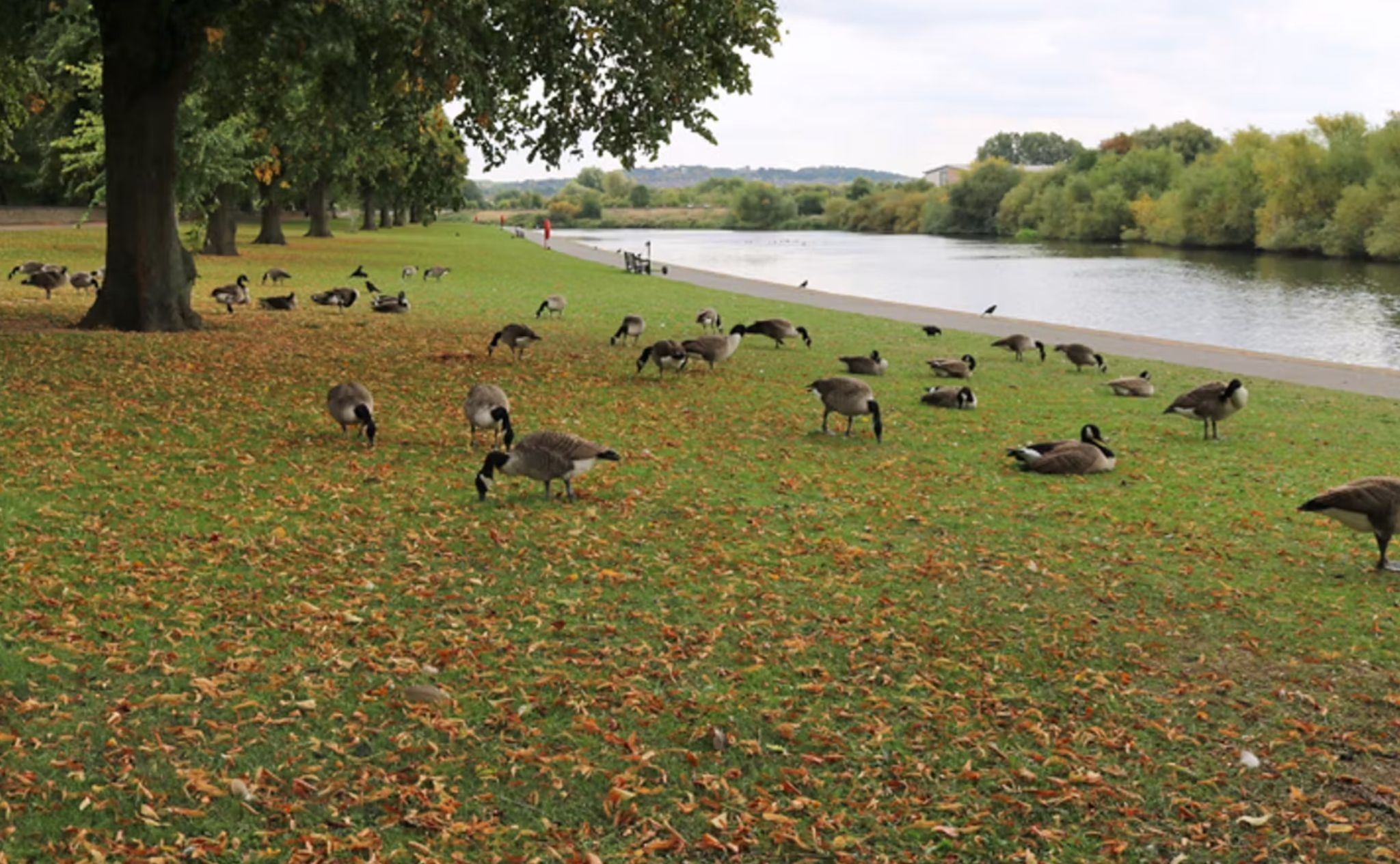
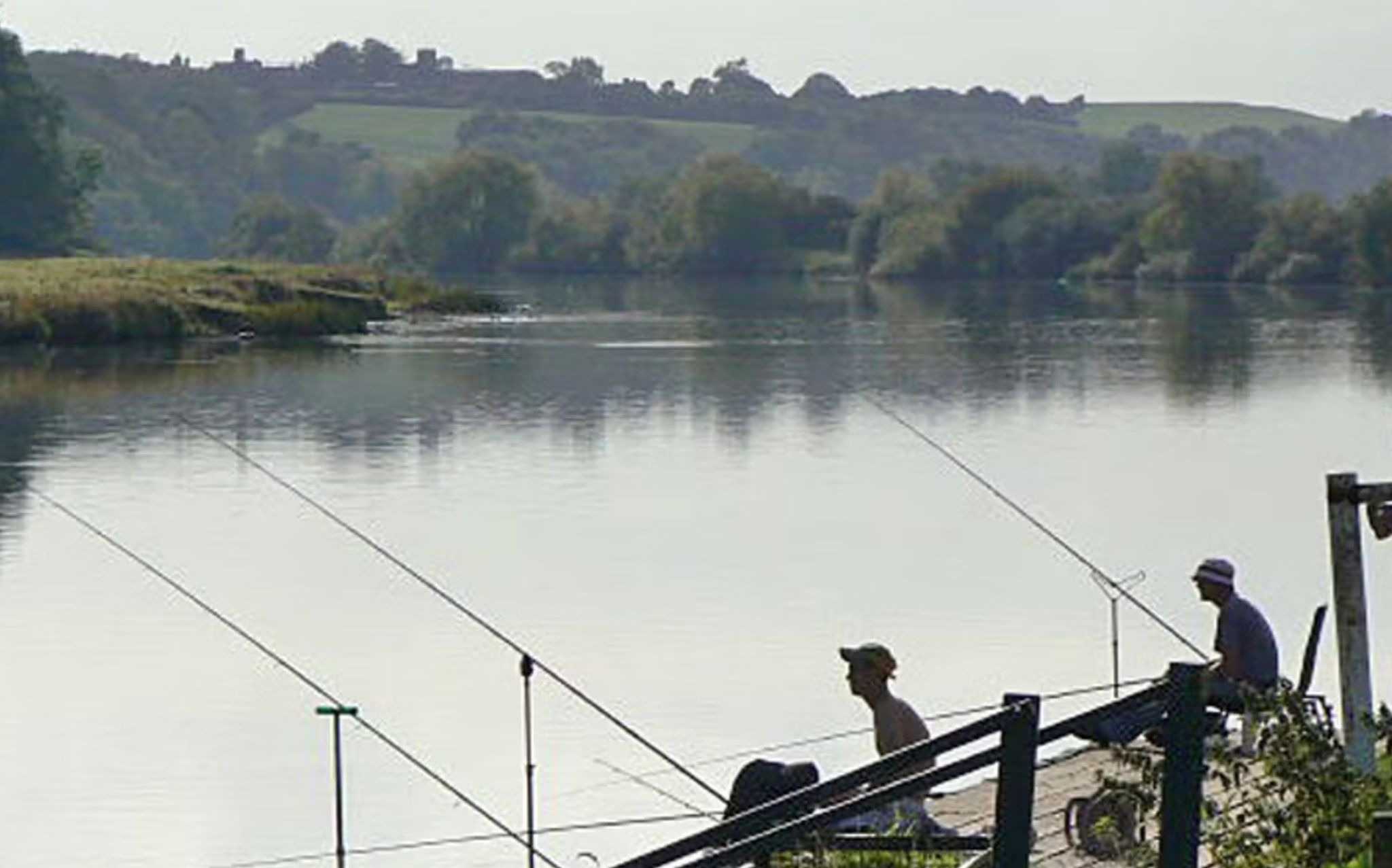
Today, the River Trent is no longer the main logistical artery of industry, but it is gradually regaining its natural significance as an ecological, cultural and recreational resource. The water level in many areas is sufficient for aquatic organisms to live, and various species of fish can be found here again, including bream, pike, perch and others. Thanks to water purification and conservation programmes, the populations of some species have begun to grow.
Recreation areas have opened on the banks of the river. People come here to walk, fish or simply enjoy nature. In summer, locals often share their impressions of the sandy beaches along the slow rapids and shallow waters—warm places for swimming, where previously, even no one could have dreamed of such a thing.
The river is no longer the symbol of industrial power that it was 200 years ago. For this, it has had to pay a certain price, accepting piles of rubbish and industrial waste from people. Today, the Trent lives on and continues to be an important part of the regional landscape. The history of this river is a story of transformation, from heavy industry to a modern ecological balance that restores natural harmony to people and the environment.
Sources:
- https://www.bbc.com/news/uk-england-nottinghamshire-64163995
- https://www.nottingham.ac.uk/manuscriptsandspecialcollections/collectionsindepth/water/trentriverauthority.aspx
- https://canalrivertrust.org.uk/canals-and-rivers/river-trent
- https://www.researchgate.net/publication/266317334_The_Unnatural_History_of_the_River_Trent_50_Years_of_Ecological_Recovery